How to use polska.fcst.pl and the fcst.pl app
RASP forecasts for gliding, paragliding, general aviation and sailing: on the website, in the phone app and in a widget for your aeroclub’s website.
The screenshots show the Polish version; the layout is the same in English (EN button on the website).
What’s new (October 2026)
Mobile app
- Push notifications about good conditions – a bell on every profile card (gliding, paragliding, airplane, sailing) with your own thresholds; the server sends a notification after each forecast update. More
- Airplane (VFR) – My flight: weather along the route at the time you fly it, route cross-section, METAR and TAF, route import from SkyDemon, Garmin Pilot and ForeFlight. More
- Airfield map for glider pilots – about 1400 airfields in Poland, Czechia and Germany with their aeroclubs; forecast, alert and widget for your field. More
- Paragliding launch site map with a distance slider – all submitted sites, pick one with a pin. More
- Sailing from your marina – marina list and map, submit new ones; the rating is for the marina, not the main location. More
- Czech and French – the app now speaks Polish, English, German, Czech and French, notifications included.
- Invite a friend from Settings. More
Website
- Wave over the Alps on a 2 km grid – new area Alps – ICON-D2 (2 km, 48 h) in wave mode: French, Swiss, Austrian and Italian Alps, the Dolomites and Slovenia, today and tomorrow. More
- Forecast for all of Europe (about 34–55° N, 11° W–26° E) from the ECMWF model run through WRF on a ~5 km grid, up to 5 days ahead.
- Help in Czech – Nápověda česky.
1. Website – polska.fcst.pl
Main screen
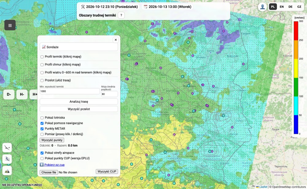
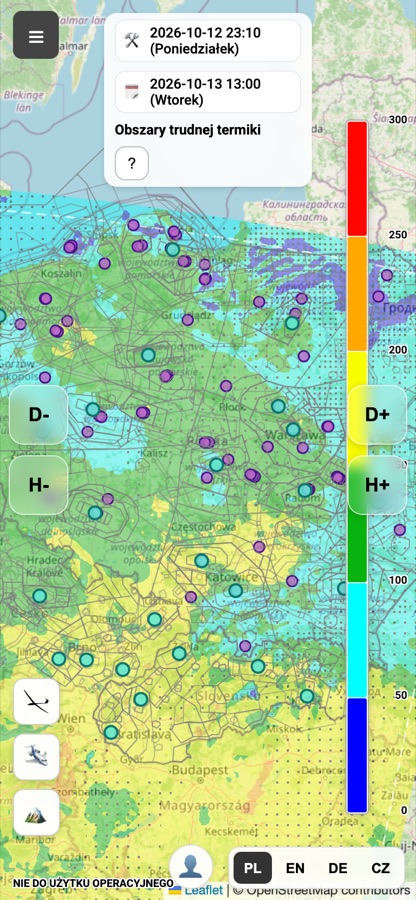
The website opens with a map of the forecast for the selected parameter over Poland. You pan and zoom the map like any web map (mouse, wheel or two fingers). The forecast also covers a large part of Europe – just zoom out.
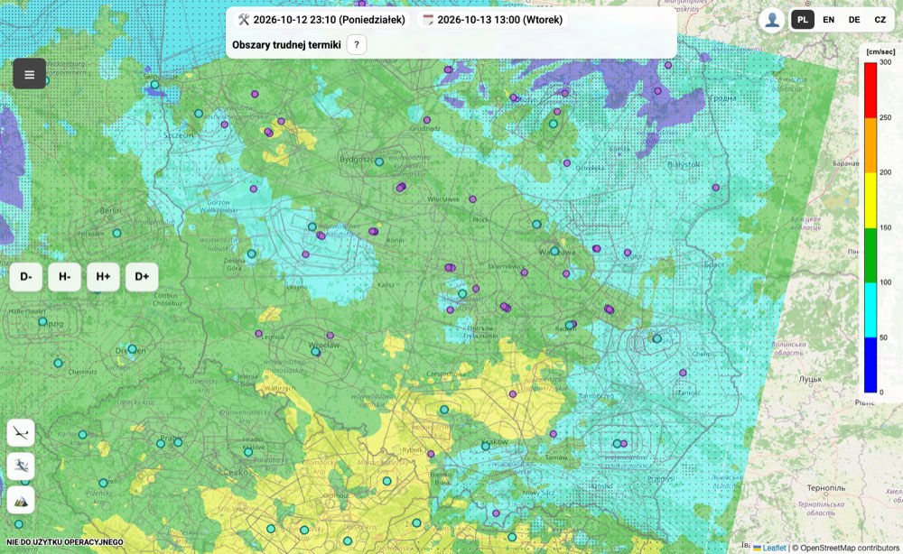
| Element | What it does |
|---|---|
| ☰ (top left corner) | List of forecast parameters – choose what the map shows. |
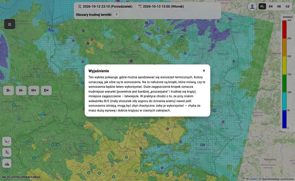
| ? next to the parameter name | Plain-language description of the parameter and tips on how to read it. |
| Day- Day+ | Previous / next forecast day (up to several days ahead). |
| Hour- Hour+ | Previous / next hour (local time). |
| 🛠️ date | When the model was computed – a new run appears every morning. |
| 🗓 date | The day and hour the map is valid for. |
| Scale on the right | Meaning of the colours and the unit of the current parameter. |
| PL / EN / DE / CZ / FR | Website language. |
| 👤 | User profile: sign-in, own points, alerts, notifications, Premium access. |
| Buttons in the bottom left corner | Profiles: gliding (tools), GA aviation (route planning), 🏔️ wave. After signing in, other profiles assigned to your account may appear too, e.g. ⛵ sailing. |
Dots and icons on the map are airfields and navigation aids, lines are airspace zones. Clicking an airfield or a METAR point shows details.
Choosing a parameter
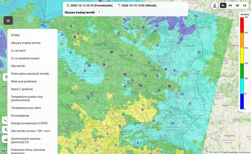
Clicking ☰ opens the list of all maps. The most used ones:
- STARS – overall rating of thermal conditions (more stars = better).
- Areas of difficult thermals – thermal strength with dots where the wind “breaks” the thermals.
- Thermal strength (w*) – average climb in the thermal; scale in cm/s (100 cm/s = 1 m/s).
- Potential thermal height – up to which height the lift can be used.
- Cu from the surface / Cu in the thermal layer – will there be cumulus and where is their base.
- Wind below cloud base, surface wind – wind strength and direction.
- Precipitation, CAPE – rain and thunderstorm risk.
- Wave – levels, wind, clouds – switches to wave mode (see below).
Don’t know a parameter? Select it and click ?.
Sign-in and profile
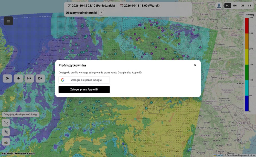
The 👤 button opens your profile. Sign in with a Google account or Apple ID (on iPhone and iPad in Safari – Apple ID). The first sign-in gives you 30 days of full access for free. After that, in the Profile → Premium tab you can ask for your access to be extended by another month.
In the profile, once signed in:
- Own points / takeoff sites – save a place by typing its coordinates or with Add point by clicking the map.
- Weather alerts – for a saved point set thresholds (thermal w*, cloud base, wind below cloud base) and the number of days ahead. The server checks alerts every day at 10:00; the Check now button checks right away.
- Notifications – Add app to screen installs the website as an app (PWA), and Enable push on this device turns on notifications. On iPhone, first add the site to the Home Screen (Safari → Share → Add to Home Screen), open it from the icon and only then enable push.
Gliding tools
Once signed in, click the glider button in the bottom left corner. The tools menu opens:
- 📈 Soundings – aerological diagrams.
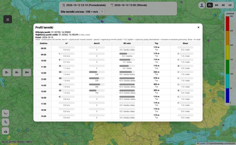
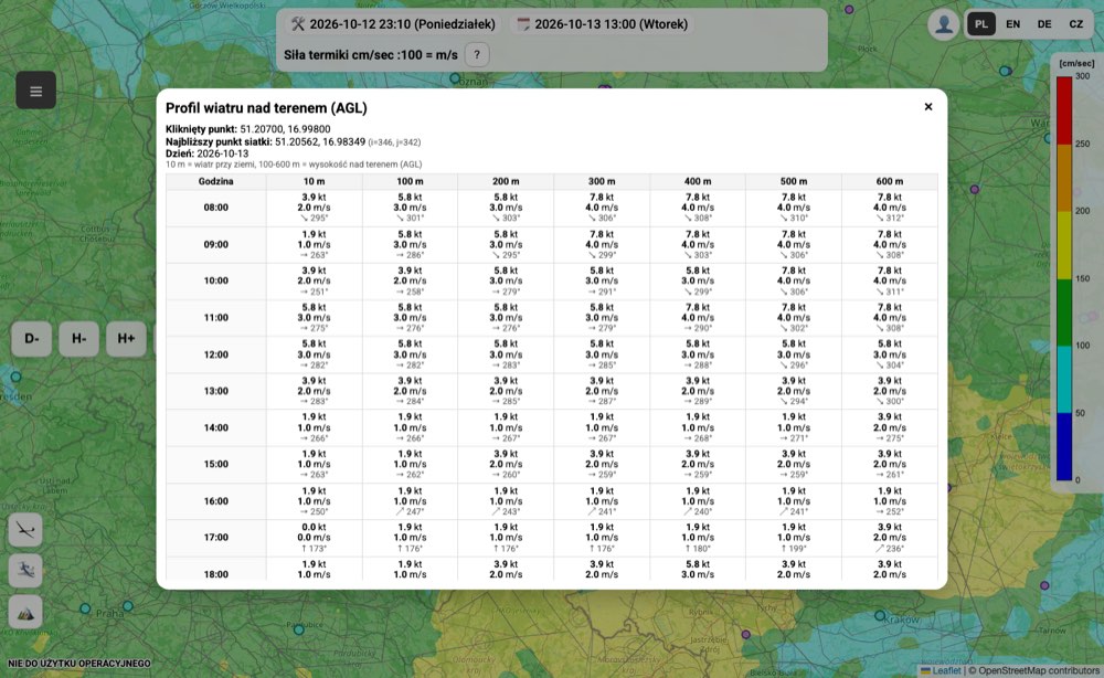
- Thermal profile, Cloud profile, Wind profile 0–600 m – tick one and click a place on the map; you get an hour-by-hour table for that point.
- Cross-country – click the route points one after another, set the minimum thermal height and your average speed, then Analyze route. The result takes the current airspace use plan (PANSA AUP) into account.
- Show airfields, navigation aids, METAR points, airspace zones – map layers.
- Measure – right-click (tap on a phone) adds points; you see the leg lengths and the total in km.
- CUP waypoints – show turnpoints (EPLU version), download
pz.cupor load your own file.
GA aviation
The 🛩️ button turns on route planning for aeroplanes:
- Set the cruise altitude [ft] and speed [kt].
- Click the route points on the map one after another. Clicking the start point closes the route.
- Click 🛩️ again and choose Analyze GA – you get the weather along the route. Print prepares a printable version.
- After changing the route, run the analysis again. Clear GA starts from scratch.
Wave
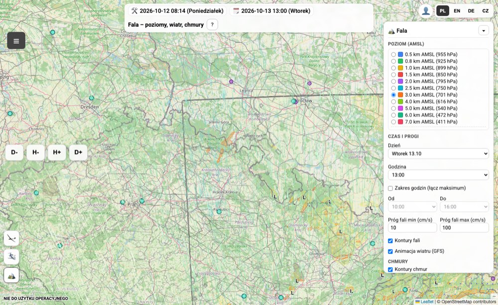
The 🏔️ button (or the Wave parameter in the list) switches the map to wave mode. The panel on the right lets you choose:
- Area:
- Europe (5 km) – wave over all mountain ranges covered by the forecast (Alps, Pyrenees, Apennines, Carpathians…), levels 1.5–6 km, hours 8–18. The 5 km grid shows large waves; short lee waves may be weaker or missing, so treat it as a guide. Wind from the same model (WRF).
- Poland – detailed (2 km) – a more accurate forecast for southern Poland (Sudetes, Carpathians), levels 0.5–7 km, hours 7–20, wind from GFS.
- Alps – ICON-D2 (2 km, 48 h) – the ICON-D2 model of the German weather service (Deutscher Wetterdienst) over the French, Swiss, Austrian and Italian Alps, the Dolomites and Slovenia: levels 850/700/600/500/400 hPa (about 1.5–7 km), hours 8–18, wind from the same model. Today and tomorrow only – for later days use the Europe (5 km) area.
Further down in the panel:
- Level (AMSL) – tick All levels to see the strongest wave from all heights.
- Day and hour or a time range (shows the maximum over the range).
- Wave thresholds in cm/s – from which climb to draw an area and from which to count it as strong.
- Wave contours, wind animation and cloud contours – layers to switch on or off.
The website on a phone
The website also works on a phone. The Day- Day+ Hour- Hour+ buttons are then on the sides of the screen, and language and profile at the bottom.
The fcst.pl app is more convenient, though: it has ready-made day ratings, alerts, offline maps and a home-screen widget. You can also install the website as an app (PWA) – see Sign-in and profile.
2. The fcst.pl mobile app
The fcst.pl app (Android and iOS) turns the RASP forecast for a chosen place into ready-made day ratings from 0 to 100: 70 good conditions, 40 average, 10 poor. Tapping a day shows the hours, the reasons for the rating and the map.
Download: polska.fcst.pl/mobile.html – Android (Google Play) and iPhone.
First start
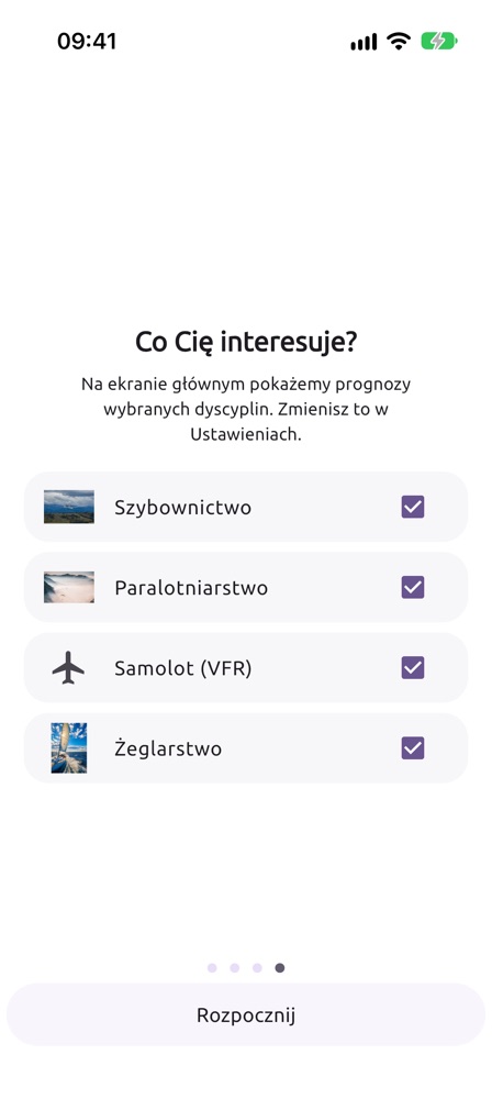
- Swipe through the welcome screens and tick the disciplines you are interested in: gliding, paragliding, airplane (VFR), sailing. Only their cards will appear on the main screen (you can change this later in Settings → Disciplines).
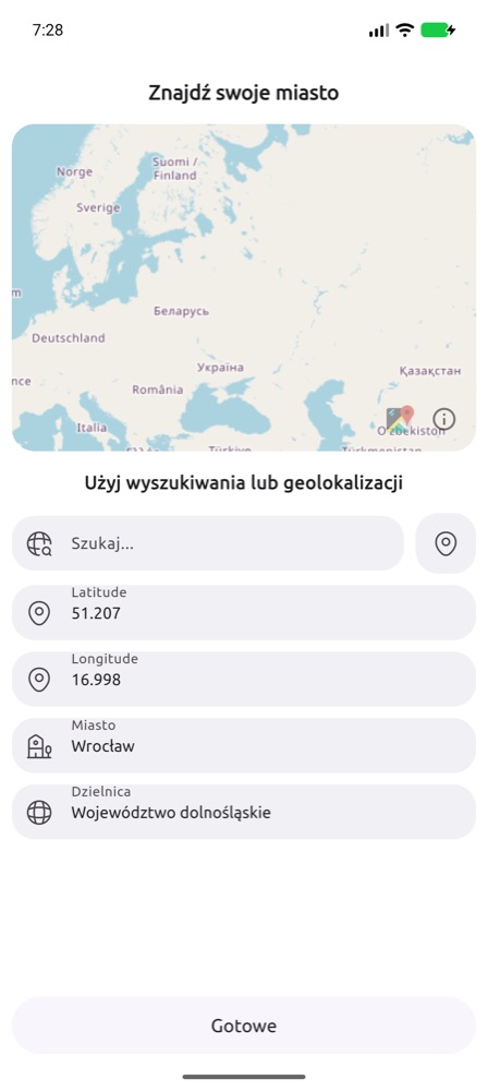
- Choose a location: type a city name in Search… or tap the pin icon to use GPS. Add more places in the Cities tab.
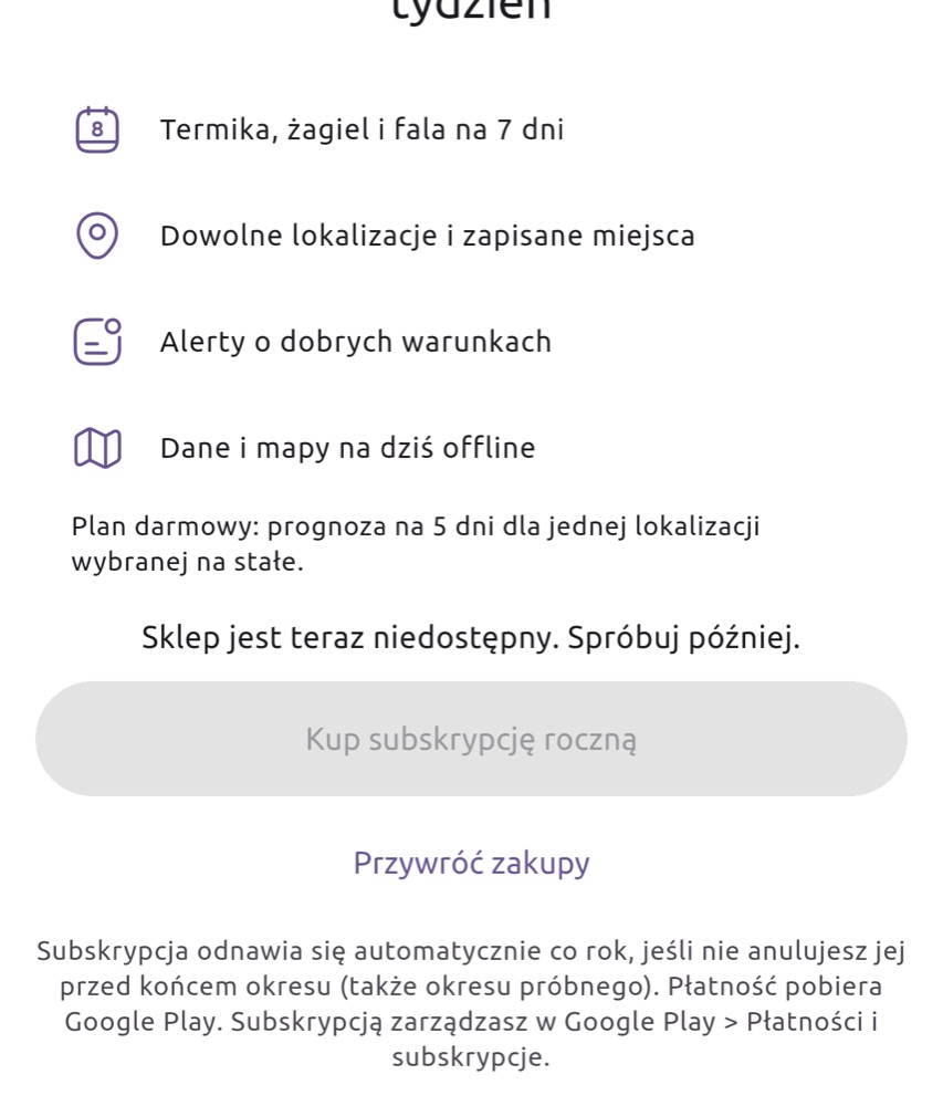
Free plan and Premium
| Free plan | Premium | |
|---|---|---|
| Gliding (thermal, ridge, wave) | 5 days, one location set permanently | 7 days, any locations |
| Paragliding | one launch site set permanently, today and tomorrow; later days – only the rating colour and warnings | all days, any launch sites |
| VFR airplane (My flight) | today, departure from now up to 3 hours ahead | any hour on the forecast days |
| Sailing | today and tomorrow | all days |
| Warnings (thunderstorms, strong wind) | yes | yes |
| Good-conditions alerts | – | yes |
| Offline data and maps | – | yes |
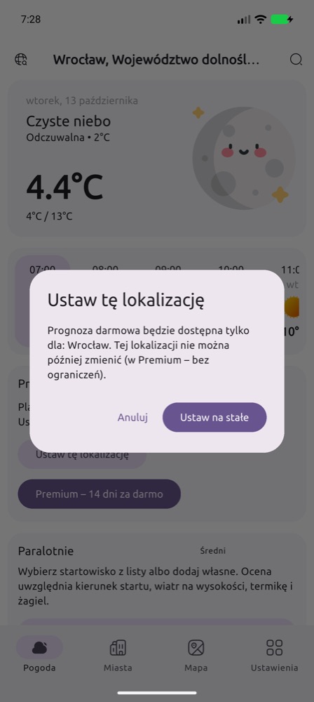
The free location (and the free launch site) cannot be changed later – choose the place you fly from most often. Premium can be tried free for 14 days; after that it is a yearly subscription that you manage in Google Play or in your Apple account settings.
Gliding
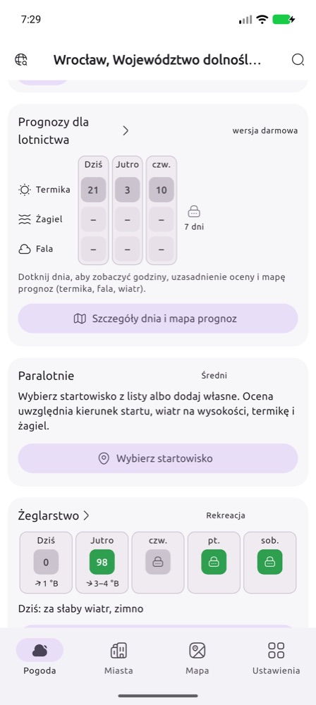
The Aviation forecast card on the main screen shows ratings for thermal, ridge (slopes nearby) and wave for the coming days. “–” means no conditions or no slopes nearby; wave is computed for all of Europe (5 km grid), in detail for southern Poland and the Alps (2 km).
Your airfield: below the card title tap Choose an airfield. The map and list show about 1400 airfields and landing strips in Poland, Czechia and Germany (OpenAIP data) – blue ones are gliding fields, Polish ones with the name of the aeroclub. The Distance from me slider narrows the view and Search by name finds a field in the whole list. Once chosen, the card, the alert (bell) and the widget use the airfield instead of the main location; Change picks another one, ⓧ goes back to the main location. Your strip is missing? Add a landing strip: the cross in the middle of the runway, a name, the ICAO code (if any) and the kind – you can use it at once, others see it after review.
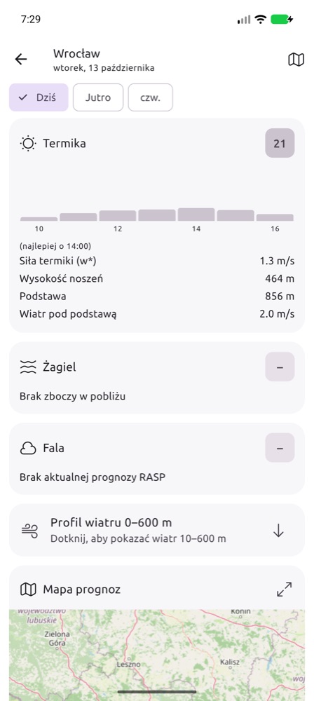
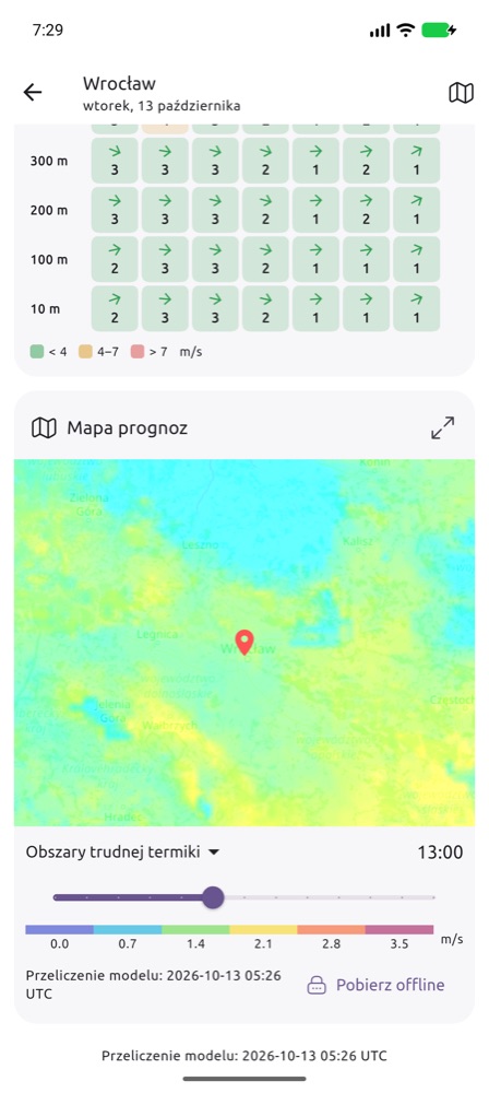
Tap a day or the Day details and forecast map button. On the day screen:
- an hour-by-hour rating chart and the best hour,
- values: thermal strength w*, thermal height, cloud base, wind below cloud base,
- the reasons for the rating (e.g. “Thermals broken by wind”, “Thunderstorm risk”),
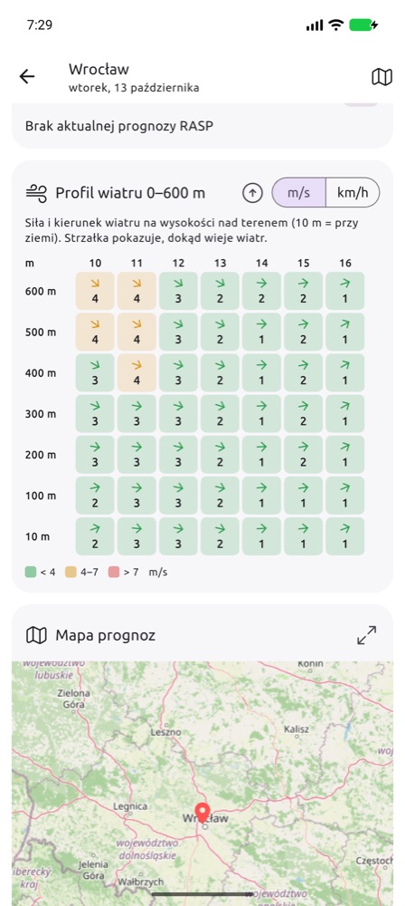
- Wind profile 0–600 m – collapsed; tap to expand,
- Forecast map – choose a layer from the list and move the hour slider. The ⤢ icon opens the map full screen, Download offline saves the maps on the phone for flying without internet (Premium).
Paragliding
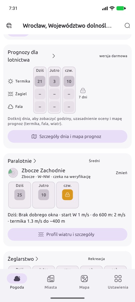
The paragliding rating is computed for a specific launch site: it checks whether the wind blows into the launch, how strong it is at launch and up to 600 m, whether there will be thermals or ridge lift, and the risk of thunderstorms, overdevelopment, turbulence and wind gradient.
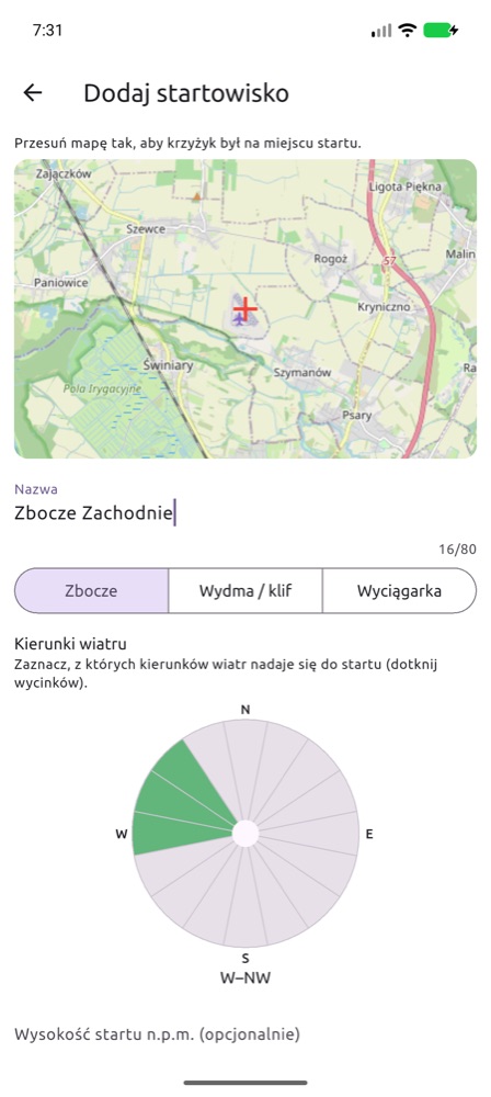
- On the Paragliding card tap Choose a launch site. The map and the list show all verified launch sites and your own submissions (orange). The Distance from me slider narrows them to a radius around your position (GPS) or the main location. Tap a pin on the map and the app asks whether to check the weather there; where pins overlap, pick the site from a list first.
- Your launch site is missing? Add launch site: move the map so the crosshair is on the launch, type a name, choose the type (Slope, Dune / cliff, Winch, Flat (PPG) – flat ground for PPG and PPGG) and tap the sectors of the wind rose the launch works for. Winch and flat sites need no directions – you launch into wind from any side. Elevation and notes are optional.
- You can use your own submission right away; others will see it after verification.
- In the free plan tap Set this location to choose your free launch site.
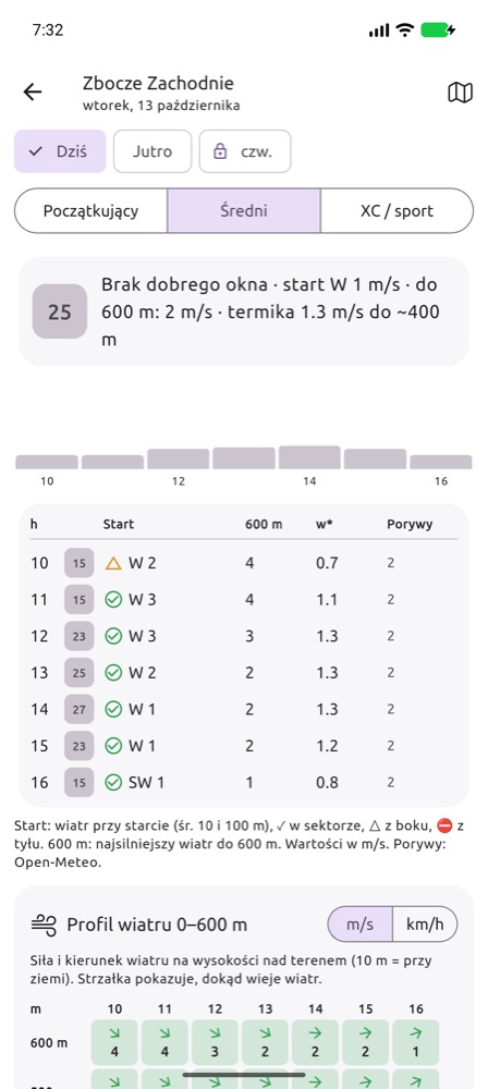
On the day screen:
- Pilot profile – Beginner, Intermediate, XC / sport. It changes the acceptable wind and thermal strength, and so the rating.
- Hourly table – wind at launch (average of 10 and 100 m) with a marker: ✓ within the launch sector, △ crosswind, ⛔ tailwind; the strongest wind up to 600 m; w*; gusts (from Open-Meteo, when the launch site is close to your location). Values in m/s.
- Warnings (thunderstorms, overdevelopment, strong wind aloft, gradient, turbulence) with times – always free.
- Wind profile 0–600 m with colours matched to the pilot profile, the launch-site description and the forecast map.
- Notify me about good conditions (Premium) – the server checks the launch site after every forecast run and sends a notification when the rating exceeds the threshold you chose.
Airplane (VFR) – My flight
A profile for airplane pilots flying under visual flight rules (VFR). You enter the route, departure time, speed and cruise altitude, and the app shows the weather where you will be, at the time you will be there: cloud base (ceiling), visibility, wind at cruise altitude, freezing level, thunderstorm and icing risk, and the METAR and TAF of the airfields on the way.
- Tick Airplane (VFR) on first launch or in Settings → Disciplines. The My flight card appears on the main screen.
- Tap Plan a flight and enter the route: ICAO airfield codes (foreign ones too) or coordinates in decimal degrees
lat,lon, e.g.51.10,16.88, separated by spaces. 2 to 20 points, at most 2000 km. - Set the departure date and time (local time), TAS (kt), cruise altitude (ft above mean sea level) and your minima: ceiling (ft above ground) and visibility (km).
- Importing a route file: export the plan in SkyDemon, Garmin Pilot or ForeFlight and choose Share → FCST (on iPhone also Open in… → FCST), or tap Import a route file in My flight. Supported files:
.flightplan(SkyDemon),.fpl(Garmin Pilot, ForeFlight) and.gpx. A SkyDemon plan also brings its cruise altitude. SkyDemon stores aerodromes as coordinates only – the departure and destination names come from the file name, and Polish airfields are recognised by position. - Tap Check the route weather. The last plan and its result stay on the phone – the card shows them offline too.
The screenshots show the app in Polish; with English selected in the app the labels are in English.
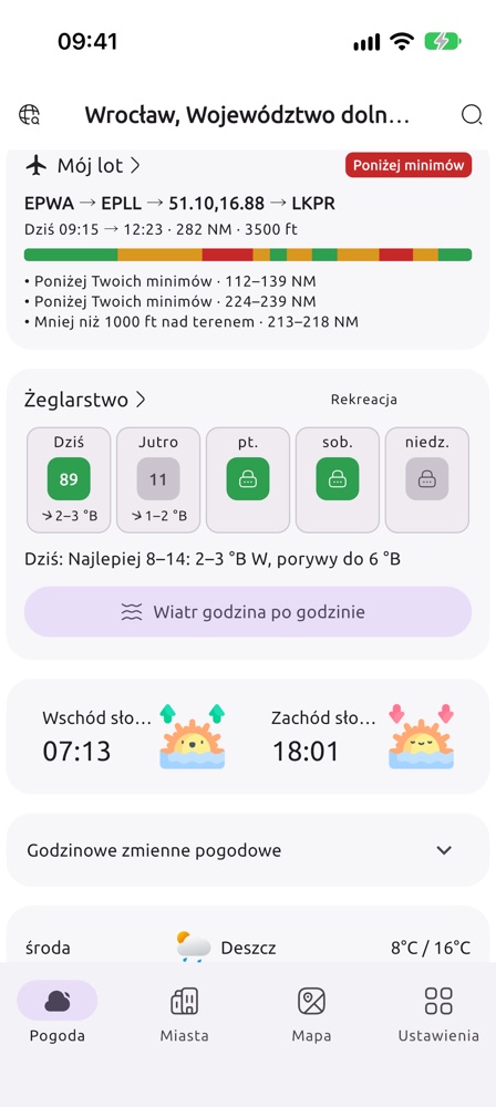
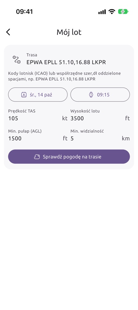
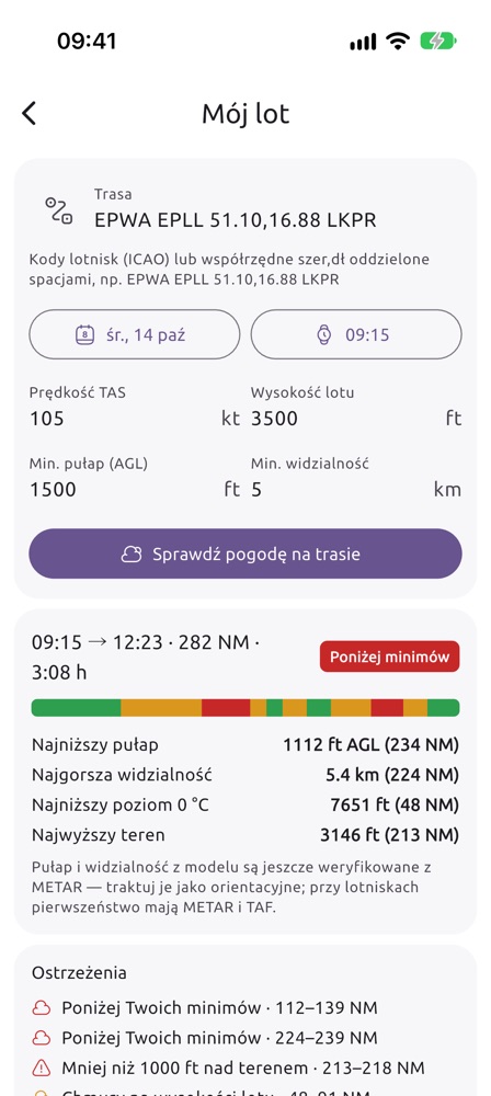
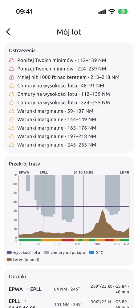
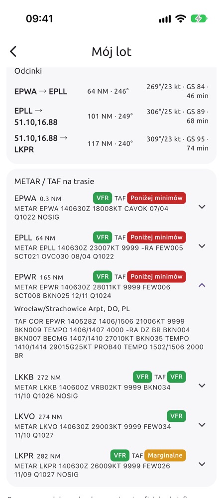
EPWA EPLL 51.10,16.88 LKPR – Warsaw Chopin, Łódź, Wrocław-Strachowice given as coordinates (the app recognises the airfield and shows EPWR), Prague Ruzyně; TAS 105 kt, 3500 ft, minima 1500 ft and 5 km. Result of 14 October (screenshots above): 282 NM, 3:08 h, overall Below minima. The strip and warnings show where: cloud at cruise altitude over central Poland, ceiling below minima at 112–139 NM and 224–239 NM, and less than 1000 ft above terrain at 213–218 NM (Sudetes). Descending is no option over the mountains – on such a day check a later departure or another route.What the result shows:
- Summary – departure and arrival, distance, flight time and the worst category on the route. The strip below is the whole route from departure to destination: VFR ceiling and visibility at least 1000 ft and 3 km above your minima, Marginal above the minima but without that margin, Below minima, grey – no forecast.
- Lowest ceiling (ft above ground), worst visibility, lowest freezing level and highest terrain – with the distance from departure in NM.
- Warnings with route stretches in NM: thunderstorm risk (CAPE from 1000 J/kg, or from 500 J/kg with rain), below your minima, icing risk (0 °C at or below cruise altitude, in cloud or in rain), less than 1000 ft above terrain, cloud at cruise altitude (base less than 500 ft above you or lower), marginal conditions, no forecast.
- Route cross-section – horizontally NM from departure, vertically ft above mean sea level: brown model terrain, grey cloud from the ceiling up, blue rain strokes, dashed blue freezing level (when it fits on the chart), purple cruise altitude, vertical lines at the waypoints and the category strip.
- Legs – distance, course, wind at cruise altitude, ground speed (GS) and time. Time comes from the wind at cruise altitude, without climb and descent.
- METAR / TAF along the route – airfields within 25 km of the route, in the order you pass them. The colour next to the METAR is its category against your minima; next to the TAF, the worst period of the whole forecast (including TEMPO and PROB). Tap an airfield for the full TAF. Source: aviationweather.gov.
On the free plan the departure must be today, from now up to 3 hours ahead; other days and times come with Premium. Warnings and METAR/TAF are always shown in full.
Sailing
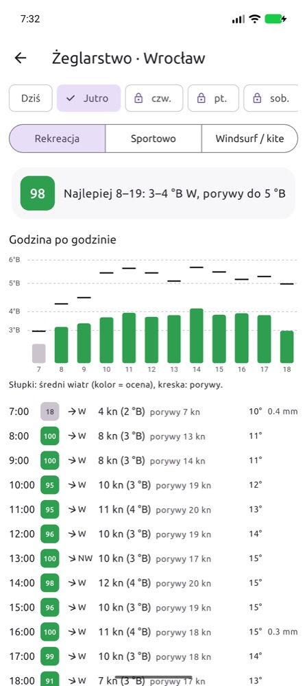
The Sailing card rates the sailing conditions for the coming days and shows the wind on the Beaufort scale. On the details screen choose a profile: Leisure, Sport or Windsurf / kite. You will see the best sailing window, a wind and gust chart and an hourly table (knots, Bft, gusts, temperature, precipitation).
Marina: tap Choose a marina (or Change next to its name). The map and the list show reviewed marinas and your own submissions (orange); the Distance from me slider narrows them. Tap a pin and the app asks whether to check the weather there. Your marina is missing? Add a marina: put the cross in the harbour, enter the name and choose the kind of water. You can use it at once; others see it after review. Until you choose a marina, the scores are for the main location.
Warnings of thunderstorms, squalls and gusts from 8 Bft appear on the card. The data comes from Open-Meteo (wind 10 m above ground) – over open water the wind is usually stronger.
Alerts and notifications (Premium)
You set an alert with the bell on a profile card on the main screen. The server checks the forecast after every model update and sends a push notification when the conditions are met – even when the app is closed.
- Gliding – thermals: minimum climb (m/s), thermal height (m AMSL), duration (h) and maximum wind below cloud base; you are notified when all conditions are met at the same time. You can also turn on ridge and wave alerts with a rating threshold of 0–100 (in the Alps from the 2 km forecast for today and tomorrow).
- Paragliding – minimum rating for the chosen launch site.
- Airplane – for an airfield: minimum ceiling (ft above ground), visibility, maximum surface wind, whether rain is acceptable and how long the conditions must last; for the route from My flight: departure window and cruise altitude – you are notified when the whole route is VFR within your minima, with no icing, thunderstorms or cloud at cruise altitude.
- Sailing – wind range (kt), maximum gusts and duration for the chosen marina.
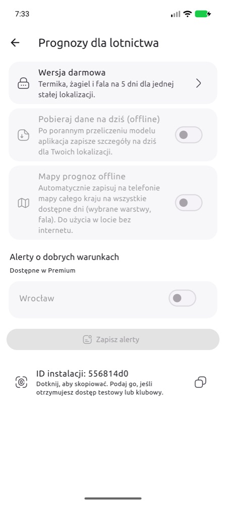
For each alert you choose how many days ahead to check (from today only to 5 days) and whether to be told when conditions get worse (a newer forecast withdraws an alert already sent). The same alert comes once per day and place; several alerts at once arrive as one notification. Nothing is sent at night (22–7 phone time) – alerts wait until the morning. All alerts are listed in Settings → Aviation forecast → Good-conditions alerts, together with the Send a test notification button.
Settings and the home-screen widget
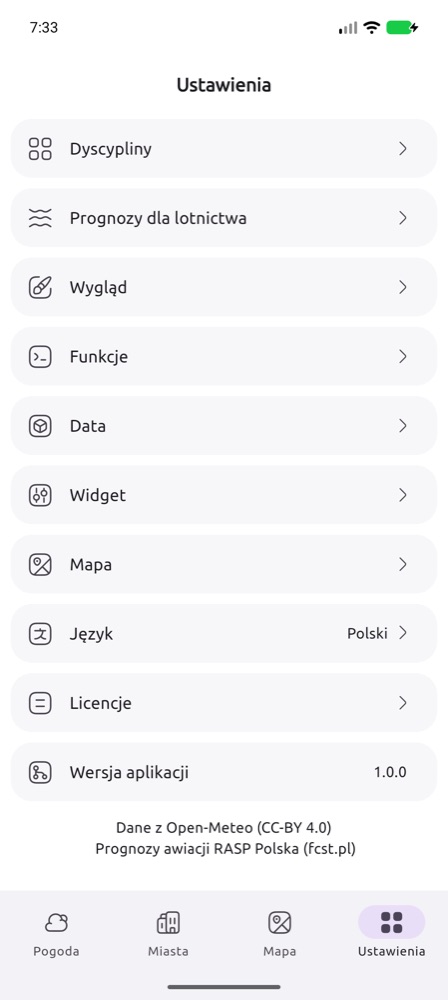
- Disciplines – which cards to show on the main screen.
- Aviation forecast – your plan, downloading data and maps for offline use (Premium), good-conditions alerts for saved locations and the Installation ID. Give this ID when you receive test or club access.
- Widget – the look of the home-screen widget. You add the widget like any other: long-press an empty spot on the home screen and choose fcst.pl from the widget list. It shows the thermal, ridge and wave ratings for the next days at your location.
- Send a test notification – checks that notifications reach this phone.
- Invite a friend (in the Help section) – sends a link to polska.fcst.pl/mobile.html by text message, messenger or e-mail.
- Language (polski, English, Deutsch, čeština, français), Appearance and other app settings.
3. Widget for aeroclubs
Aeroclubs can show the RASP forecast for their airfield on their own website for free: thermal, ridge and wave ratings for the coming days, the hour window, thermal strength, cloud base and wind. No registration, no ads, no cookies. The widget updates itself after every model run.
- Set the language, number of days and look – the preview and the code change right away.
- Copy the code and paste it on the club website: in WordPress as a Custom HTML block, in site builders (Wix, Joomla…) as an Embed code / Embed / HTML element.
- If a scroll bar appears in the frame, increase its height.
Rating colours in the widget: ≥ 60 good conditions, 30–59 average, < 30 poor. “no slopes” means there are no slopes for ridge soaring near the airfield, and “out of range” that wave is not computed for this place.
Another airfield – code generator →
4. Questions
- When does a new forecast appear? The model is computed every day; new maps for the coming days appear in the morning (around 6:00–7:30). The run date is shown on the website (🛠️) and in the app below the map.
- How many days ahead? On the website – several days (Day+ button). In the app – 5 days in the free plan and 7 in Premium (as long as the model already has data for those days).
- Where do I get the app? From polska.fcst.pl/mobile.html – store links and a QR code to scan with your phone.
- Which area does the forecast cover? Poland and a large part of Europe (about 34–55° N, 11° W–26° E). Wave: all of that European area on a 5 km grid, plus southern Poland in detail (2 km) and the Alps on a 2 km grid (ICON-D2, today and tomorrow).
- Which time zone are the hours in? Local Polish time (Europe/Warsaw, CET/CEST).
- Maps do not load in the app without internet. Offline maps have to be downloaded beforehand (Premium): the Download offline button below the map or automatic download in Settings → Aviation forecast.
- My airfield is not in the widget generator. Write to support@agg-systems.eu – give the name and coordinates.
- Privacy. Details in the privacy policy.